Pages That Mention Columbia River
Coast Guard District narrative histories 1945
54
channel five feet deep from the mouth of the Snake to Lewiston, Idaho, 139 miles upstream. However, this portion of the river presented additional problems in that the rise in elevation to Lewiston from the mouth was 400 feet and the waters swift and shallow. Army Engineers had surveyed this section in 1934 at a cost of $150,000.00 but by 1940 the survey marks were missing and existing maps of the river were unreliable. Althought railway lines paralleled the Snake River on either side to Lewiston, most of the shipping in the area was done by barge as the freight charges for rail transportation was excessive. In anticipation of the Army's proposed dredging, wheat elevators had been constructed along the banks of the Snake, in spite of the fact that river traffic had been discontinued for some time prior to the Army's proposed project. Improvement of the Snake River was calculated to reduce the price of waterborne gasoline about 1 cent at Lewiston and 3/4 cent at Spokane and to insure navigation at least nine months of the year. On the strength of the Army's proposal, Headquarters allotted $33,000.00 for the establishment of aids along the Snake to Lewiston but this was later diverted to other projects as so little progress was made by the Army in the dredging of the proposed channel by 1945.
Ranges were not established even though there was a minimum of river traffic near Lewiston as the Board felt that the establishment of any aids implied responsibility for the safety of the courses over which soundings and chart data were incompleted. By the end of World War II, river traffic on the Columbia had reached a peak. Day and night, winter and summer, through fog or clear weather, tugs and barges, fishing boats and other commercial marine craft plied the river from Astoria, Oregon to Pasco, Washington. The Upper Columbia had been thoroughly marked with additional aids to insure safe navigation; Army Engineers had dredged channels to promote commerce; and inland navigation companies had increased their tonnage so that by 1945 the Columbia River had taken its place amongst the top ranking commercial waterways of the world. But, at Pasco, extensive river traffic ceased for beyond this point the conditions of the river made through traffic impossible. Although the Columbia reached for hundreds of miles beyond Pasco, Washington, all commerce was localized in small areas along its length.
AIDS IN ROOSEVELT LAKE
The building of the Grand Coulee Dam on the far reaches of the Columbia, to provide water for irrigation and water power for this great Northwest section, brought about additional activities for the Aids to Navigation Section. The building of the dam created a lake which extended almost 200
-34-
55
miles from Mason City to the Canadian border. A question arose as to whether or not Roosevelt Lake constituted part of "the navigable waters of the United States" as interpreted by the laws. In March, 1944, the Law Officer advised that Roosevelt Lake was navigable and, together with the Columbia River which flows into it and gives rise to it, furnished a water way for foreign commerce. With this fact established, it became necessary to establish aids to navigation along the lengths of this lake. At that time, there was very little traffic on Roosevelt Reservoir but it was the opinion of local marine interests that the traffic was bound to increase not only commercially but in pleasure craft following the war. Numerous hazards existed that made travel especially dangers under the conditions as they then existed. In a meeting between the Superintendent of the Coulee Dam and representatives of the District Coast Guard Officer, location were proposed for spar buoys to be anchored in the lake and provide the shortest run from Grand Coulee Dam to Kettle Falls, Washington. These locations were consistent with assumed limitations of 20 feet of water at buoy locations with a maximum reservoir drawdown at elevation 1208 and a minimum distance between the buoys 1/2 mile; the normal elevation of the reservoir when full is 1290. An investigation made by the Aids to Navigation Officer determined that 27 lights and 10 reflectors would suffice to mark the lake. The Bureau of Reclamation was in favor of the establishment of 51 buoys but the District Coast Guard Officer felt that buoys would be impracticable for several reasons. Due to the lowering of the water to different levels which would cause different shoal areas to appear and changes would have to be made in the buoys to keep the channel safely and effectively marked. Furthermore, the mountainous land area which formed the bottom of the lake together with the deep water, rendered use of buoys inadvisable; for in many places the buoys would be moored in over 200 feet of water which would require large buoys and, consequently, the services of a buoy tender. Unlighted buoys were not considered, for, as such, they would be inadequate. For these reasons then the Aids to Navigation Officer determined that the 27 lights and 10 reflectors would be adequate. These lighted aids would consist of a battery box on a concrete foundation with a 200mm lantern with a focal plane of 12 feet. Aids were to display a white light of 90 candlepower, flashing either every 4 seconds, 6 seconds or 10 seconds, and were to be serviced by the Seattle Operating Base twice a year with half of the batter cells being relieved at a time. The Bureau of Reclamation extended the use of one of its boats to be used in establishing these aids and in the servicing of them.
-35-
57
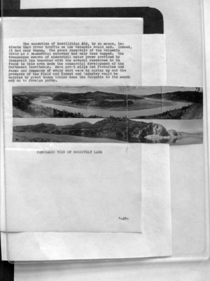
The cessation of hostilities did, by no means, indicate that river traffic on the Columbia would end. Indeed, it had only begun. The great reservoir of the Columbia River as a commercial waterway had only been tapped. The tremendous source of electrical water power provided by Roosevelt Dam together with the natural resources to be found in this area made the commercial development of the Northwest inevitable. Here great mills and factories and farms and commerce of every sort were to spring up and the products of the field and forest and industry would be carried by great barge trains down the Columbia to its mouth and on to foreign ports.
(image) PANORAMIC VIEW OF ROOSEVELT LAKE
-37-
59
"Blackout" entered the universal vocabulary with the advent of World War II, although, it had, in some degree, been used in all previous wars. The blacking out of municipal lights became the activity of the Civilian Defense Organization, but the problem of extinguishing lights on river and railroad bridges and the blacking out and silencing of navigational aids fell to the Coast Guard. Accordingly, The Commandant advised all Districts in October, 1940, that plans for the extinguishment of lighted aids and the silencing of sound signals were to be prepared in the event of a serious national emergency. In the 13th Naval District, a Board was immediately organized for the purpose of making a study of meeting any emergency which called for the purpose of interruption of the operation of navigational aids in the Seattle District, including all Canadian aids in the Strait of Juan de Fuca. The District Coast Guard Officer ordered this Board to study the Strategic areas of the Columbia River entrance, to study several bar harbor entrances, San Juan Islands and the Puget Sound Area, and to formulate a Blackout Plan. The Plan was submitted to the Commandant, 13th Naval District for approval, as the Coast Guard operated its blackout through the Senior Naval Officer of the District.
This Blackout Plan, as approved in September, 1941, divided the District into seven areas, designated as Blacks One to Seven, and each Black was further subdivided into seven sections indicated by letter so that any part of any area could be blacked out separately. The "S" Code, developed previously by Communications for exclusive use in this District, was enlarged to accommodate blackout activities in all communication between Coast Guard units. For example, if all aids in the District were to be blacked out, the "S" signal was "Signal 26"; if the lights were to be blacked out and the sound signals silenced, the "S" signal was "Signal 138". If a blackout was designated in Black One Area, the signal was "Signal 26-1A", etc. An "S" Code Signal Book was published for issuance to all units. Appropriate "S" signals were also prepared for the relighting of all aids.
Radiobeacons were not silenced under the general blackout but were covered by individual instructions to the Commanding Officers as required. Although an effort was made to cover all aids, it was understood that aids omitted or aids established after the Plan was distributed were to
-39-
62
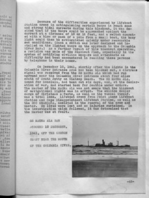
Because of the difficulties experienced by Lifeboat Station crews in extinguishing certain buoys in rough seas and strong tidal currents during this blackout, it was decided that if the buoys could be approached against the current at a distance of 10 or 12 feet, and a switch operated with a blow or push of a pole from a small boat, the buoy light could then be extinguished quickly under reasonable sea conditions. (Such a switch was later designed and installed on the lighted buoys on the approach to the Columbia River Bar.) As a further result of this blackout operation, a revision was made of the Blackout Plan, especially in the system of notifying civilian keepers and attendants as difficulty had been encountered in reaching these persons by telephone in their homes.
On December 10, 1941, shortly after the lights in the Columbia River Entrance Area had been blacked out, a distress signal was received from the SS MAUNA ALA which had run aground near the Columbia River Entrance about four miles south of South Jetty on Clatsop Beach. The SS MAUNA ALA, bound for Honolulu, had been out six days, and, at the declaration of war, had started back for Seattle under orders. The Master of the MAUNA ALA was not aware that the blackout of navigational lights was in effect. The million dollar cargo of Christmas effects, as well as the vessel itself, was a total loss. Lifeboat crews from Point Adams Lifeboat Station and Cape Disappointment Lifeboat Station, as well as the CGC ONANDAGA, assisted in the removal of the crew and Master. No lives were lost and no injuries sustained. In the investigation which followed, it was determined that the Master was at fault.
SS MAUNA ALA RAN AGROUND 10 DECEMBER, 1941, OFF THE OREGON COAST NEAR THE MOUTH OF THE COLUMBIA RIVER.
(image)
-42-