Pages That Mention Whidbey Island
Vol 313 LH at CF letter 1873
2
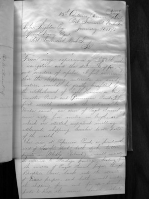
13th Customs Revenue L. Dist. Port Townsend Wash. Ter. Rufus ??? Eng. January 31. 1873. Special Treasury Agent. Port Townsend, Wash. T. Sir x x x x x From my experience of Puget Sound navigation and the statements of ??? and masters of vessels I feel convinced that the shipping interests on said waters, would be greatly benefited by the establishment of Light Houses on Foulweather Point and Possession Point. It first would indicate that entrance to Hood Canal, an arm of Puget Sound, some sixty five miles in length, on which are situated important milling settlements, shipping lumber to all parts of the world.
The one at Possession Point, a point southeast of Seatchets Head (both of the latter point on (Whidbey Island) would indicate the entrance to Saratoga Passage, leading from the waters of Puget Sound proper, through Deception Pass, back into the Straights of Fuca proper, and both would enable the shipping from and for up-sound ports to keep the ??? channel without
Coast Guard District narrative histories 1945
83
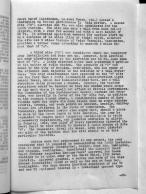
Coast Guard Lighthouse, Lookout Tower, etc.) placed a limitation on beacon performance in this sector. A second site ("B") elevated 300 ft. was also considered for the RACON Station. The site was only a mile from Moon Island Airport, with a road for access and with a mast height of 50 ft. It afforded operation seaward for surface craft up to a distance of 24 miles (line of sight) which, although the site was 9 miles inshore of Point Chehalis, Washington, provided a better range extending to seaward 3 miles beyond that of "A".
A third site ("C") was considered where the temporary Army installation had been set up. However, this location had many disadvantages as the elevation was 40 ft. less than that of "B". A large elevated water tank presented a problem in the matter of radio shadow. The property at "C" was owned by the City of Hoquiam, Washington, and the owner of the adjacent land objected to the building of a tall structure. The only disadvantage that appeared at the "B" site was the fact that a Civil Aeronautics Administration Light Beacon Tower, which had been established there, had a tall structure which produced a shadow. However, the various structures could be located so that the shadow would occur to the east where it would not affect an overall performance. The Commander of the Northwestern Sector, Western Sea Frontier, was heartily in favor of the "B" site for, in addition to the reasons stated above, a considerable number of Navy flights used the route via Moon Island when en route between Astoria, Oregon, and such points as Shelton, Seattle, Whidbey Island and Arlington in the State of Washington. The Commander, Northwest Sector also urged that, should a place be made by the Coast Guard in this location, the Army be requested to remove their temporary installation to avoid unnecessary duplication, and probable confusion to pilots. In January, 1945, the Chief of Naval Operations directed the Coast Guard to take action to install a RADAR Beacon at Site "B". The Commander, Naval Air Bases, 13th Naval District was also of the opinion that the site should be at this particular location.
Before work had progressed to any extent, the Army announced that it proposed to decommission the RACON installation at Cape Meares (Oceanside), Oregon, Neah Bay, Washington, and Hoquiam, Washington. Immediately the District Coast Guard Officer requested Headquarters' approval for these stations to be taken over by the Coast Guard, 13th Naval District. Approval granted, a survey was made of the Cape Meares (Oceanside) RACON as well as the one at Neah Bay, Washington. The Cape Meares location consisted of one YJ and one YK equipment located in a rubberized Quonset type
-63-

