Pages That Mention Greenwich
p-2 Notice To Mariners
2
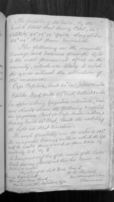
The position of the tower, by the United States Coast Survey Pilot, is: Latitude 44 degrees 36 minutes 35 seconds north, Longitude 124 degrees 04 minutes west from Greenwich.
The following are the magnetic bearings and distances from the light to the most prominent objects in the vicinity, which are likely to catch the eyes or attract the attention of the mariner:
Cape Perpetua, South 20 degrees east, distant 26 miles. Celilike Head, South 17 1/2 degrees east, distant 8 miles.
In approaching Yaquina entrance, mariners should observe the following directions, viz: Yaquina Point (or Cape Foulweather) bearing north 34 degrees west, limits the visibility of the light in that direction.
The angle of visibility over the water is 238 degrees. The magnetic bearings, within which the light will be visible from a vessel, are from N.N.W. by southerly to S. by E.
A dangerous reef lies off the mouth of the harbor. Vessels passing should not have less than 12 fathoms water.
By order of the Light-House Board:
Treasury Department Office Light House Board Washington, D.C. September 1871
W.B. Shubrick, Rear Admiral, U.S. Navy Chairman
