Pages
BSY_FB_28-031
Umm idj-Djimâl 7:30 A.M. Temp 29 ° Baro. S 27.15 " L. 27.50
Heavy Hoar frost.
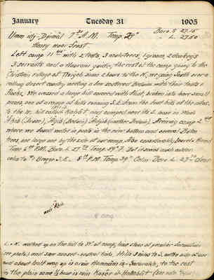
Left camp 11:45 with 2 tents, 3 muleteers, 1 groom, 2 donkeys 3 servants and a Haurani guide, the rest of the camp going to the Christian village of Ṭîsiyeh some 2 hours to the N., we going South over a rolling desert country meeting a few scattered Beduins with their tents & flocks. We crossed a large hill covered with flint, broken into small pieces, one of a range of hills running S.E. from the foot hills of the mtns. to the W. hill called Tell il-Ḳaḥât, and camped near its S. base in Wadi 'Âḳib (Druse), 'Âgib (Beduin) 'Âdjib (another Beduin). Arriving camp 2:45 where we found water in pools in the river bottom and several Butm trees, one large one by the side of our camp. Also considerably Laurel & Ḥamḍ
Time 6:00 P.M. Baro. L 27.70 Temp 59 °F. But it seems much colder. calm to #1 Breeze S.E. 8:10 P.M. Temp. 39 ° Calm Baro. L. 27.70 clear.
[drawn topographic map showing N, S, E, W directions with wadi 'Âḳib and *camp labelled]
L. & N. walked up on the hill to W. of camp, line stone of peculiar formation (see photo.) and saw sunset - neutral tints. Hills 3 miles to S. on the side of one and about half way up is a ruin Ḥammâm iṣ-Ṣararakh, to the east in the plain some 1/2 hour is ruin Ḳoṣêr il-Ḥallabât (see note 2/6/05)
BSY_FB_28-032
Camp on Wadi 'Âḳib 3 hours S. of Umm & near S.E. base of Tell il Ḳaḥât, & by a large butm tree. Below this point Wadi is called Dhelêl. 7:00 A.M. Temp 39 ° Baro. L 27.52 Baro. S. 27.40 #1 N.E. Breeze nimbus & stratus all. 4 Beduin horsemen rode into camp at 7:30. They were of the Benī Haṣan tribe, that control this country. They dismounted in a business like way, walked to the fire, asked who was in charge, were referred to the dragoman, asked him wehe? we were going & what we were doing, asked him if we would mind breaking bread with them in token of friendship, said they were looking trying to round up some stray camel, slung themselves gracefully on their horses, said "go-bye" and cantered out of sight over a little roll of ground in the desert. One of them was a shëkh.
We left camp. 7:55 A.M. leaving 3 muleteers to guard with a Winchester & 2 six shooters. We went S. over a nearly flat country covered for the first 2 miles with black Basalt volcanic scoria, and then with a fine yellow clay with scanty grass and bunches of Ḥamḍ looking much like a meadow. We came in one hour to a ridge of hills rising approx 200 ft. above the plain and extending to the W.S.W. and of lime-stone covered with particles of flint & agate (see specimens) called the "Zumal" or "sandy rolling country". On the summit of a hill some 100 ft. high at the E. end of the ridge we came to a ruined castle Ḥammâm iṣ - Ṣarukh?. It was very cold and raw, and we had quite a snow squall, the snow turning to light rain with variable wind settling to N. in afternoon. The situation commands a fine view to the S., E., & N. but higher hills of lime stone to the W. & S.W. cut off an extensive view in that direction. As far as the eye can see there is not a sign of life - no flocks, no Beduins, no water,
BSY_FB_28-033
In camp, Wadi 'Âḳib 8:00 A.M. Temp. 35 ° Baro. S 27.60 Baro. L 27.95 Clear, Calm, Tents frozen stiff
Left camp 9:38 A.M. going N. but one mile to E. of our way down Crossed Wadi 'Âkib at once and crossed range of hills extending 1/3 mile E. from Tell il- Ḳaḥâṭī and really a part of it, to the E. of which flows Wadi 'Âkib which we recrossed in 20 mins. keeping it on our West and 1/2 mile distant and parallel to our route N. until we recrossed it at 11:35 at a point about i? hr. S. of Umm idj-Djimâl. We stopped for lunch at 12:04 on a knoll approx. distance 1 1/4 miles - direction accurate from tower of castle at Umm idj-Djimal. From this point I took compass bearings, while L. went nearer Umm to copy inscriptions by a tomb and B. went into the town to finish up some work. I left the place where we had lunch at 2:53, taking out 10 mins. for stop at tomb and passing Umm 1/3 mile to E. proceeded toward "Kulêb" - that land mark for miles around - going approx. N.E. by N. over a rolling country mostly covered with volcanic scoria, but gradually rising to a higher elevation by some 300 ft. until at 5:00 P.M. we reached the top of the divide between the Wadi Butin & Wadi 'Âkib. We could look back far down the long gentle slope of the steppe and see probably for the last time Umm idj-Djimal asleep in its blue white bed of haze, basking in the late afternoon sun - just as it has been for so many centuries, with the blue hills far behind. Nearer to us on the crest of a slight roll of ground were 3 camels lazily munching the scanty desert growth with their solitary Arab herder beside them - the only sign of living thing. I turned in my saddle to contemplate the sad but lovely scene and to wave "farewell" to the venerable " Mother of Camels" - Sweet shall be her memory.
BSY_FB_28-034
Ṭîsiyeh 8:00 A.M. Temp. 37 ° Baro. S 26.85 Baro L. 27.20
Clear, Calm.
Left Ṭîsiyeh going N.E. at 9:40 arrived Simdj 10:05, a medium size village pop. C. & M. passed through without stopping arriving 10:10 Dêr Simdj, a convent ruin inhabited by C. & to the E.N.E of Simdj. Left at 12:00. B & L. having gone back to Simdj in mean time & having return to Dêr Simdj - and travelled E. by N. arriving 12:30 at Umm is-Snêneh a small village completely ruined. N. took compass bearing from here, and left at 2:20 returning to Ṭîsiyeh. B. & L. left at 2:20 going E.N.E. arriving at Ṣmâd a medium sized Moslem village with signs of medeival? Moslem reconstruction at 3:00. Left at 4:15 going a little N. of E. arriving at 4:25 Sebsebeh a small uninhabited ruin on Wadi Butm with a fine birkeh. Left at 5:00 comming? straight through to Ṭîsiyeh without stop - passing through Ṣmâd 5:10, Simdj 6:00, arriving Ṭîsiyeh 6:40 roads fair & through plowed fields all day - peasants plowing. pace 2 1/2 miles country rolling G.M.
The Christians at Ṭîsiyeh tell tales of Druse oppression. Only two days ago they say - but I hardly believe it although it may be so -- a woman of the town was murdered in the fields by the Druse.
BSY_FB_28-035
Ṭîsiyeh 8:30 A.M. Temp. 41 ° Baro. S 26.80 Baro L. 27.14
light E. air few cumulus.
L & N. spent one our looking at Ṭîsiyeh, a small C. village in centre of a sea of plowed fields & rolling country. Broke camp at 10:05 - going S.S.E mostly on Roman Road arriving at Kôm irRuff 11:05 pace 2 1/2 miles road g.s. (g.m.) rolling country plowed fields near Ṭîsiyeh then desert. K ir-R a completely ruined bldg. originally built of large uncut stone & situated on the divide between Wadi Butm & Wadi 'Âkib. Left at 11:54 going 5 points E. of S. country & conditions same but gradual slope. Crossed Wadi 'Âkib at 12:24 arriving at Ṣubḥîyeh 12:28 a small uninhabited group of ruined dwelling houses of the better Hauran class. N. left at 1:48 going E. by S. over rolling desert country keep Wadi 'Âkib 10 mins. to N. and arrived at Ṣabḥah 2:09 walking horse slowly. Ṣabḥah is a deserted town of considerable size Ṣubḥîyeh & Ṣaḅḥah are womens names & mean "Morning". B. & L. stayed at Ṣubḥîyeh about 3/4 hrs. longer & then rode to camp. There are about 15 Beduin tents pitched here, mostly those of the Druse shepherds. They say they are assembling for the purpose of "razooing" (Ghazu the Beduins of the Belḳā who killed one of their number and wounded 6 others stealing 100 of their sheep 4 or 5 days ago near Tulûl Kharâneh a hill 3 hours to S.E. of Ḳoṣêr il-Ḥallabât on the East side of which is reported to be a ruined castle Ḳaṣr Kharâneh