Pages
(seq. 1)
Cambridge 4 May 1812
{Reverend} Sir,
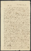
Your very learned letter of 27 April, arrived safe during my absence, & on my return I received it. There will be no need of adding that it gave much satisfaction as all your communications do. Inclosed I send you a very rough sketch of my ideas on the subject. The drawing is a mere caricature, but it will answer the end of a chalk. Before the destruction of Sodom Jordan flowed down thro' the low plains & emptied its waters into the Red Sea, & there was no lake of Sodom. After that Event, the country from Zeboim to Sodom being sunk by an earthquake the river overflowed the meadows till it came to the foot of the hills on each side, when the evaporation becoming equal to the [supplies?], there was no surplus to flow in the old channel down to the red Sea, an auxilliary brook called by Moses Zered, which had contributed its waters to Jordan now ran the other & joined the lake at Zoar its southern extremoty. In the days of the kings the country thus deserted by its river, abounded in trees & was called Eziongeber or the great forest. The same term was also applied to the port town at the head of the Elanitic Gulf where Solomon had his royal dock. The tract of Country in which the Great Forest was situated was also called the Low plains, & as the wood began to be cleared was valued for the pasture it afforded, Solomon made cedar to be as common at Jerusalem as the Sycamores in the Low Plains; & Uzziah had much cattle in the Low plains. Solomon pitched upon Eloth for his dock yard & part because of the forest, & it was nearer to Jerusalem than any other port on that Gulf. The Sea has sensibly decreased in depth & in width in both branches since Solomon's time as is determined by the Sea marks now found some miles from the Shore. If we adopt the Same rule which measures the mediterranean, we shall allow the red Sea to have shoaled a foot in a century since Solomons time, which will make the water which now termi
(seq. 2)
the Elanitic Gulf to have been then near thirthy feet deep. Let us Sup-pose further that Adjeroute was then at the head of the western gulf as Suez is at present, & allows the same change to be wrought in the length of the Eastern gulf, & [?] shall place Eloth about a dozen miles further toward the north, than the present head of the bay. The two heads as they at present exist are different sides of an Island, & probably Eloth is not far from what I have made the upper end of it. The shores as far as they are blackened are taken from [Anville?], but the [Seah?] magnified. The Supplementary parts of the river are supplied marked with yellow, & Supplied to the map by myself. You will judge how far the appearance is natural. I believe the sketch, if not perfect, will give a clear outline of the subject. The situation of the few towns I have taken from Danville, of except two down the gulf, from {Mount} Montagne.
The position of the north end of the dead Sea is pretty well ascertained by the multitudes of travellers. The length & breadth are, as you know, variously reported. Excuse me while I endeavor to make another statement on a subject to which the proper principles of surveying have not been applied & where we have no astronomical observation, to guide us. The maps are all constructed from Itineraries. This will answer very well for such places as Jerusalem, Jericho & Hebron Whose mountains being in sight of each other, the bearings by a pocket compass would serve to correct the itineraries. We shall therefore suppose those positions to be correct.
Moses tells us that the angels who breakfasted with Abraham arrived at Sodom before Sunsett. They probably left him at ten or eleven o'clock before noon, & I think we cannot allow more than twenty five miles for the walk including all the windings of the path in a rought country. Let us deduct one fifth for windings, & it will leave twenty miles for the direct distance on air line from Hebron to Sodom. This last place could not have been more than three miles north of Zoar; for Lot left it at daybreak & arrived at Zoar at Sunrise. If we stretch compass to Hebron & sweep an arch
toward the lake, It will be found that the direct distance from Hebron to Zoar is equal to that the distance from Zoar to the mouth of Kedron two or three miles from the mouth of Jordan, & we shall have the whole length of the lake at about 25 or 26 miles = to about 200 or 208 furlongs. The distance between the [two?] seas will be about Sixty miles. Petra I have placed according to D'Anville's map. Eloth is placed by Calmet ten miles {South} of Petra, my Sketch makes the upper end of the supposed Island outward of Thirty miles from Petra. Petra is I believe now alled Beder Hunein
If these remarks make D'Anville's map too large as it respects the Sea of Sodom, it will also make it be too small as respects the distance between the two seas. But the extreme points are Sufficiently ascertained. Cape Mahomet is fixed by astronomical observation, & the position & length of the Elanitic gulf by bearings from the top of Sinai, [a?] [?] Seems to command the view of the whole gulf. If then we have the north end of the Red Sea well fixed & also the north end of the Dead Sea by its relation to Jerusalem & Jericho, we have two extremes points between which lies Zoar. All the question then of the distance of the two Seas depend on the length of the Dead Sea, which I have endeavored to reduce to 26 miles.—
Sodom was about three miles from Zoar, & Zeboim about as far from the North end of the lake. This makes the distance of these two towns to be about twenty miles. The valley in which Kedron runs from Jerusalem to the Dead Sea was called in the time of David the valley of Zeboim, & in it the Philistines encamped. It is now called {Saint} Saba a Saint whose name is a corruption of its ancient one. As Zeboim stood near the confluence of Kedron with Jordan Admah occupied a station near the mouth of Arnon By a similar principle of convenience Gomorrha stood at the mouth of a stream which D'Anville supposes to be the Zered of Moses, & which he brings from the Mountains of Moab, & Sodom stood where a rivulet called by D'Anville Suzuma joins its waters to those of Jordan. This places them all in the scipture order. D'Anvilles Saphia I believe
(seq. 3)
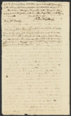
to be the Zered of Moses. Will Petra agree to the cliff Liz mentioned in the return of Jehoshaphat from his [Moabitiah?] campaign? But I have [taxed?] you, & myself into the Bargain. I have not yet had the pleasure to see either {Captain} Storer or {Mister} [Booun?] Yours sincerely, James Winthrop
{Reverend} {Mister} Bentley
In the second sketch Petra is placed forty miles below Zoar, an idea taken from [Maritis'?] history of the kingdom of Jerusalem under the Crusades I have given the Dead Sea the length of 26 miles & allowed from Eloth to Petra about [60?] miles & from Petra to Zoar 40, & from Eloth to the present head of Red Sea 20 or one third of a degree of Latitude whole distance from Zoar to present head of Red Sea 120 miles.